


Deep Dive: 4D Millimeter-Wave Radar—Linpowave's Core Technology for All-Weather AI Drone Autonomy
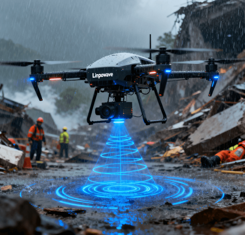
As AI Drones (UAVs) advance into critical applications like Drone as First Responder (DFR) and high-precision industrial inspection, the demand for all-weather, high-accuracy sensing has become the central driving force for industry growth. The limitations of traditional optical sensors and legacy radar technology in adverse weather and complex environments necessitate a more robust solution.
Linpowave, leveraging its deep expertise in 4D Millimeter-Wave Radar technology, is providing the core sensing solution to overcome the most difficult environmental perception challenges facing AI drone autonomy. This article analyzes how 4D mmWave radar is fundamentally restructuring drone perception systems, enabling truly reliable, next-generation autonomous flight.
I. The Critical Need for All-Weather Autonomy in Advanced Drone Operations
The integration of drones into high-stakes sectors like public safety and industrial asset management has revealed a stark gap between potential efficiency and real-world operational reliability. The key to closing this gap lies in achieving true 24/7, all-weather autonomy.
The Unstable Efficiency of DFR Programs
DFR programs, where drones act as the first point of aerial contact in emergencies, have demonstrated profound success. Data from programs like those in Redmond, WA, and Chula Vista, CA, provides compelling evidence of this transformation:
-
Accelerated Response: DFR drones frequently achieve an average response time of under 90 seconds to Priority 1 calls. The Redmond Police Department, for instance, reported their drones were 48% faster to the scene than the average officer response time. This speed is critical, as every second counts in a developing emergency.
-
Resource Optimization: DFR allows agencies to clear a significant percentage of calls (often 20% to 38% in early programs) without dispatching a patrol car, freeing up valuable ground units for higher-priority incidents. This optimization enhances overall operational effectiveness.
However, this efficiency is inherently unstable because the current generation of DFR drones relies heavily on optical sensors (cameras and traditional LiDAR). A sudden storm, dense urban fog, or nighttime mission immediately compromises this efficiency, forcing missions to be cancelled or downgraded. The public safety sector cannot afford to have its critical assets be limited by daylight or good weather.
The Sensor Limitation Trilemma
Achieving level-4 autonomy for drones requires solving a trilemma posed by conventional sensors:
-
Optical Vulnerability: Cameras and standard LiDAR operate poorly when visible light is scarce (night) or obstructed by atmospheric particles (rain, snow, smoke). In a high-fog environment (visibility ), LiDAR performance is severely attenuated due to light scatter and absorption.
-
3D Radar Blind Spots: Traditional 3D radar lacks the elevation resolution needed to differentiate obstacles vertically, which is fatal for drones operating near infrastructure. This inability to discern target height impacts safe navigation near power lines, bridge understructures, or low-hanging cables.
-
GPS Denial and Urban Canyons: In dense urban areas or deep industrial sites, GPS signals can be denied or degraded. Autonomous systems must rely on robust local sensing for precise navigation and localization—a task often beyond the capabilities of standard optical or low-resolution radar systems.
II. Linpowave’s Technical Solution: The Fundamentals of 4D mmWave Radar
4D Millimeter-Wave Radar overcomes the limitations of previous sensing technologies by providing four dimensions of data—Range, Velocity, Azimuth Angle, and Elevation Angle—all within a single, robust data stream. Linpowave achieves this through dedicated design for the high-frequency 76–81 GHz band.
1. Advanced Architecture for Superior Perception
Linpowave’s approach leverages cutting-edge radar architecture to maximize data fidelity and resolution:
-
MIMO Array Technology: We employ sophisticated Multiple-Input Multiple-Output (MIMO) antenna arrays. By synthesizing data from multiple virtual antennas, the system achieves vastly improved angular resolution, particularly in the crucial elevation axis, without increasing the physical size or complexity of the hardware. This is key to differentiating obstacles in the vertical plane.
-
High-Frequency Penetration: Operating in the 76–81 GHz band provides two key advantages:
-
Higher Resolution: The shorter wavelength enables much finer range and velocity resolution, critical for distinguishing small objects (e.g., small drones, branches) at long distances.
-
Atmospheric Penetration: These wavelengths pass through non-metallic environmental elements (rain, fog, dust) with minimal attenuation, ensuring mission continuity in harsh weather, which is impossible for visible or infrared light.
-
2. Guaranteed Performance Parameters for Industrial Reliability
The Linpowave Drone/UAV Series is engineered to meet industrial and public safety requirements for reliability and precision. The technical specifications reflect a commitment to high-performance autonomous flight:
III. 4D Radar's Indispensable Role in Sensor Fusion and AI
No single sensor can fulfill all the requirements of Level 4 drone autonomy. The true power of 4D mmWave radar is realized when it acts as the stable, reliable anchor in a multi-sensor fusion architecture.
1. The Redundancy and Complementarity Mandate
Sensor fusion provides the safety net required by public safety and industrial regulations. The 4D radar provides unique data that is complementary and redundant to optical systems:
-
Robust State Estimation: When visual data is compromised by fog or dust, the 4D radar provides continuous, low-latency data on target range, velocity, and altitude. This data is vital for the flight control system (FCS) to maintain stable state estimation and trajectory tracking, preventing crashes due to sensor dropout.
-
Velocity Accuracy: Radar excels at measuring velocity with high precision (e.g., ). This direct velocity measurement is superior to velocity estimates derived from visual odometry or sequential LiDAR scans, significantly improving the accuracy of Collision Prediction Algorithms during high-speed flight.
2. Enabling Advanced Autonomous Functions
The rich 4D point cloud data allows AI algorithms to perform complex tasks previously limited to high-density LiDAR systems:
-
Smart Obstacle Classification: By combining accurate spatial (X, Y, Z) and temporal (Velocity) data, machine learning models can classify obstacles more robustly than with 3D radar. The system can learn to distinguish between static clutter, a moving vehicle, a hovering small drone (in Counter-UAS), or a high-tension cable, enabling intelligent rule-based avoidance.
-
Precision Landing in Degraded Environments: For industrial drones needing to land on charging pads or inspection points, 4D radar can be configured to detect specific ground markers (e.g., corner reflectors). The distance accuracy is combined with high-resolution altitude measurement to guide the drone down safely, even if visual landing cues are obscured by fog or night.
-
Generating Environmental Maps: The high-resolution 4D point cloud supports the generation of detailed 3D maps for terrain mapping and digital twinning applications. This is critical for post-mission analysis and pre-flight planning in complex industrial sites, complementing data collected by other sensors.
IV. Overcoming Integration and Operational Challenges
Integrating advanced 4D radar into an aerial platform requires addressing specific challenges related to size, power, and data processing.
1. SWaP Optimization (Size, Weight, and Power)
Unlike automotive applications where size and weight are less constrained, drone integration demands strict adherence to SWaP optimization. Linpowave addresses this through:
-
Compact Form Factor: The Drone/UAV Series is designed to minimize payload impact, ensuring maximum flight time and flexibility for integration onto multirotor and fixed-wing platforms. Lightweight design is paramount for maximizing operational range.
-
Edge Computing: By integrating powerful System-on-Chip (SoC) processing directly into the radar module, the system performs complex signal processing, beamforming, and point cloud generation on the edge. This minimizes the computational burden on the main flight controller and reduces the need for high-bandwidth data transmission, which is crucial for reducing overall system power consumption.
2. Certification and Regulatory Compliance
The path to scaled autonomy, especially BVLOS (Beyond Visual Line of Sight) and DFR 2.0 (fully automated launch/recovery), is gated by regulatory approval (e.g., FAA waivers). Regulators demand robust, reliable Detect-and-Avoid (DAA) systems. The 4D mmWave radar serves as a cornerstone for DAA systems, providing the reliable, long-range, and all-weather sensing required to demonstrate equivalent or superior safety levels to human visual observation, thereby accelerating the certification process.
V. Future Outlook: The Evolution of 4D Radar in AI Drones
The trajectory of autonomous drone technology points toward an increasing reliance on robust, synthetic sensing capabilities where 4D radar plays a central role.
-
Increased Resolution: Future advancements in 4D Imaging Radar are expected to further increase angular resolution, potentially rivaling 16-line or 32-line LiDAR point clouds in density, but critically retaining the all-weather advantage. This convergence of radar and LiDAR capabilities will redefine drone sensing standards.
-
V2X (Vehicle-to-Everything) Integration: As 4D radar becomes standard in both automotive and infrastructure sensing, drones equipped with this technology can seamlessly participate in V2X communication protocols. This enables enhanced cooperative perception and swarm capabilities within a smart city ecosystem, allowing drones to share critical, real-time positional and velocity data with ground vehicles and infrastructure.
-
DFR 2.0 Enabling Technology: The move from human-in-the-loop DFR 1.0 to fully autonomous DFR 2.0 hinges on a sensor system that guarantees reliability. The 4D mmWave radar is positioned as the enabling technology that provides the necessary redundancy, precision, and environmental resilience for automated take-off, route execution, and landing in any condition, finally securing the full, continuous value of AI drone autonomy.
Linpowave is dedicated to advancing the state-of-the-art in 4D mmWave radar to ensure that our partners can unlock the full, reliable potential of their AI drone fleets, regardless of time or weather.
Frequently Asked Questions (FAQ)
Q1: What is 4D mmWave radar, and how does it differ from traditional 3D radar?
A: Traditional 3D radar provides target Range, Velocity, and Azimuth. 4D mmWave Radar adds the fourth dimension: Elevation (vertical angle). This key addition allows the radar to generate a denser, three-dimensional point cloud, enabling precise discrimination between aerial and ground objects, which is vital for safe drone autonomy.
Q2: Can 4D mmWave radar fully replace other drone sensors?
A: No. 4D radar is best utilized in sensor fusion. It excels in all-weather robustness, velocity measurement, and privacy, but it works in conjunction with cameras and LiDAR to provide comprehensive situational awareness and redundancy, ensuring safety across all scenarios.
Q3: Linpowave’s 4D radar supports "Precision Landing." What accuracy can be achieved?
A: Our systems are designed for high-accuracy localization. Utilizing the radar's distance accuracy (better than ) combined with high-resolution altitude data, the system provides the sub-meter precision necessary for fully autonomous, centimeter-level precision landing maneuvers, even when visual guidance is unavailable.
Q4: How does 4D radar protect privacy in public safety applications?
A: This is a crucial benefit. The radar outputs point cloud data and abstract parameters (location, velocity), but does not capture images or video. This inherent characteristic safeguards the privacy of individuals, making it ideal for monitoring applications where visual intrusion must be avoided.
Q5: Is 4D radar susceptible to electro-magnetic interference (EMI)?
A: Modern 4D mmWave radar, particularly those operating in the 76–81 GHz band, are highly resilient to EMI. Linpowave’s use of MIMO technology and optimized signal processing includes algorithms specifically designed to filter out and suppress noise from external radio sources, ensuring data stability even in electromagnetically dense urban environments.
Is your next-generation AI drone platform equipped with the all-weather sensing core necessary for mission reliability and regulatory approval?