


Why digital elevation model generation matters in field mapping
Digital elevation model (DEM) generation is one of those workflows that looks simple on paper and becomes frustrating the moment the data gets messy. Engineers, survey teams, robotics developers, and geospatial product managers all run into the same issue: a map may show where objects are, but not whether the surface rises, dips, or changes enough to affect drainage, navigation, grading, line-of-sight, or machine control. That difference matters. A flat-looking dataset can hide slopes, berms, depressions, and canopy effects that later show up as bad design assumptions or unreliable autonomous behavior.
For buyers, the real question is rarely whether elevation data is useful. It is how to turn raw sensor inputs into a dependable surface model, and how to choose the right method when the environment is partly open, partly cluttered, or constantly changing. That is where DEM generation becomes a practical decision rather than a cartographic one.
What a DEM helps you decide
A digital elevation model represents the bare-earth or surface height of terrain in a form software can use for analysis, planning, and control. In manufacturing and field robotics settings, it often supports route planning, cut-and-fill analysis, obstacle avoidance, and site inspection. In agriculture, mining, construction, and forestry, it can help teams identify slopes and irregular ground before equipment arrives.
The important detail is that not all elevation models answer the same question. A ground surface model can be useful for grading. A surface model that includes tree canopy or structures may be better for operational awareness. If the wrong surface is modeled, the downstream decision can be wrong too.
How DEM generation differs from a 2D map
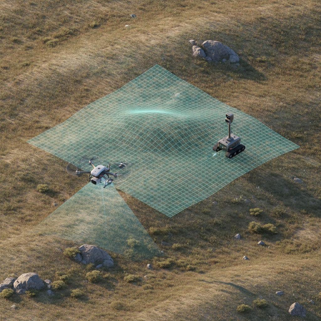
Teams sometimes start with 2D occupancy grid mapping because it is easier to visualize and faster to compute. That is useful for local navigation, especially in robotics, but it only tells you whether space is occupied at a given plane. It does not fully describe vertical relief. DEM generation adds that third dimension, which is why it is often the next step once a project needs more than obstacle detection.
In practice, both outputs may be used together. A robot or vehicle can use a 2D occupancy grid for immediate path planning and a DEM for slope evaluation or broader terrain understanding. That combination is common in systems built around Simultaneous localization and mapping (SLAM), where position estimates and map building happen at the same time. The point is not that one replaces the other. It is that each solves a different problem.
Core methods used in terrain and surface modeling
Sensor fusion and SLAM-based mapping
SLAM-based systems can build maps while tracking motion, which is useful when GPS is weak or unavailable. For DEM work, the quality of the resulting elevation surface depends heavily on sensor calibration, motion estimation, and how well the software filters transient objects. A passing vehicle, a moving branch, or a person in the scene can distort a surface if the pipeline is too permissive.
Ground surface profiling
Ground surface profiling focuses on extracting the actual terrain rather than everything above it. This is often a better fit for earthworks, trail assessment, and inspection of natural terrain. It can be demanding, though. Soft ground, wet surfaces, and mixed vegetation can make the separation between ground and non-ground less reliable, especially when the dataset is sparse.
Vegetation penetration for mapping
Vegetation penetration for mapping becomes important in wooded or overgrown areas where the underlying ground is partially obscured. Buyers should be cautious here: “penetration” is not magic. It depends on sensor type, point density, scan geometry, and processing rules. In dense canopy, even a strong dataset may only expose parts of the ground, so the final model should be treated as an engineered estimate, not a perfect surface.
Selection criteria that actually matter
When choosing a DEM workflow, start with the environment and the decision you need to support. Open sites with clear sight lines are generally easier than orchards, forests, or industrial yards full of vertical clutter. If the terrain is mostly open, a simpler pipeline may be enough. If the site includes vegetation, retaining walls, or machinery, you will need more aggressive filtering and better quality checks.
Resolution matters, but so does consistency. A very fine grid sounds attractive until the input data cannot support it. That usually produces a model that looks detailed and behaves inconsistently. It is often better to choose a resolution that reflects the density and accuracy of the source data, then verify the result against known landmarks or survey points when available.
Also pay attention to the processing step after capture. DEM generation is not just a sensor task. It is a classification, interpolation, and validation task. If the workflow does not document how outliers are removed or how holes are handled, the model may be hard to trust in a real production setting.
Common mistakes buyers should avoid
One frequent mistake is assuming that any elevation output is suitable for engineering use. Another is ignoring how motion, dust, rain, glare, or vegetation affect the source data. A field system can look impressive in a demo and still fail on a real site because the environment is less tidy than expected. That is especially true when teams move from indoor robots to outdoor terrain, where the conditions change by the minute.
It is also easy to over-focus on capture hardware and under-focus on the software pipeline. If the model cannot separate ground from elevated clutter, the result may be visually appealing and operationally weak. For procurement teams, that is the part worth challenging during vendor evaluation.
Practical buyer advice
Ask suppliers how their workflow handles sloped terrain, partial occlusion, and non-ground objects. Request examples that match your site type, not just polished demo scenes. If your project involves robotics, ask how DEM generation integrates with navigation and SLAM outputs. If you need site planning, ask how the model supports ground surface profiling and whether the chosen approach can handle seasonal changes or evolving vegetation.
As a rule, the best solution is the one that produces a usable surface consistently, not the one that claims the highest theoretical detail. That sounds obvious, but it is where many projects drift off course.
Frequently asked questions
Is DEM generation only for survey teams?
No. It is widely used in robotics, infrastructure inspection, agriculture, mining, and environmental mapping.
Does a DEM replace a 2D occupancy grid?
Usually not. The two outputs serve different planning needs and often work best together.
Can vegetation be ignored in elevation modeling?
Not safely. Dense vegetation can obscure the ground and affect the quality of the final surface model.
What to do next
If you are evaluating DEM workflows, start by matching the method to the terrain, then test how well the pipeline handles clutter, slope, and partial visibility. A good model should help your team make better decisions, not just generate a nicer-looking map. That is the standard worth holding vendors to.