


Frequently Asked Questions About Drone Radar Altimeters
Drone radar altimeter technology is revolutionizing how unmanned aerial vehicles (UAVs) navigate and operate safely in diverse environments. As drones become integral to industries like agriculture, surveying, and delivery, understanding this core component is essential. This FAQ addresses common queries on drone radar altimeter systems, helping users grasp their benefits and applications.
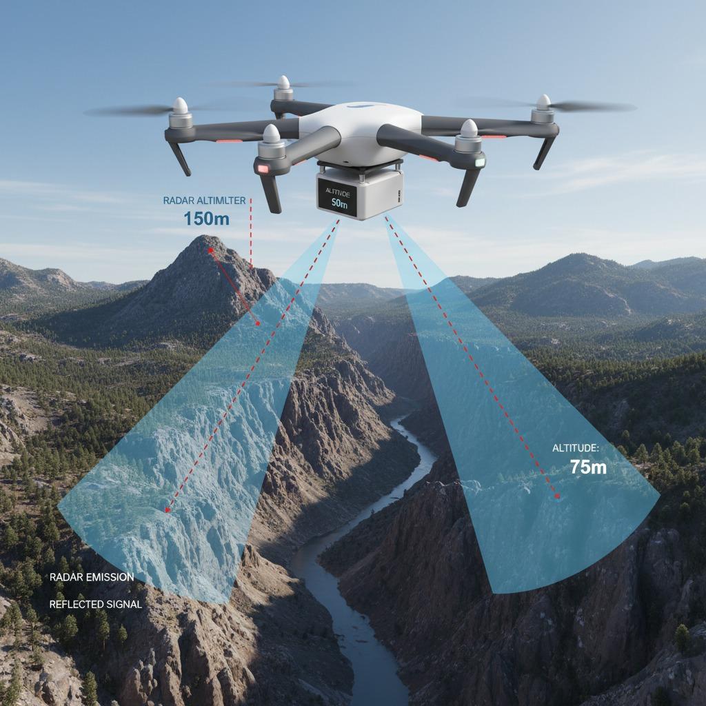
What Is a Drone Radar Altimeter and How Does It Work?
A drone radar altimeter is a sensor that measures the altitude of a drone above the ground using radar waves. Unlike traditional methods like GPS or barometric sensors, it provides precise height data by emitting radio waves and calculating the time it takes for the echo to return. This makes it ideal for low-altitude flights where accuracy is critical. For instance, in challenging terrains or during emergency operations, the drone radar altimeter ensures reliable performance without interference from weather or obstacles.
Why Choose a Radar Altimeter for Drones Over Other Altitude Measurement Methods?
A radar altimeter for drones offers superior precision compared to ultrasonic or optical sensors, especially in varying conditions. Drone altitude measurement via radar is unaffected by light levels, dust, or fog, providing consistent readings up to several meters. Traditional GPS can drift at low heights, while barometers are prone to pressure changes. A radar altimeter for drones delivers millimeter-level accuracy, making it perfect for tasks requiring exact positioning, such as precision agriculture or infrastructure inspections.
How Do Aerial Drone Radar Systems Enhance Flight Safety?
Aerial drone radar systems integrate seamlessly into drone autopilots to enable terrain-following and obstacle avoidance. These systems use advanced radar to detect ground proximity in real-time, preventing crashes during automated flights. For example, in search and rescue missions, aerial drone radar systems allow drones to hover steadily over uneven landscapes. Coupled with features like automatic landing protocols, they significantly reduce operational risks, ensuring compliance with aviation regulations.
What Role Does Precision Altimetry in Drones Play in Professional Applications?
Precision altimetry in drones is crucial for applications demanding high accuracy, such as mapping and photogrammetry. By providing sub-meter resolution, precision altimetry in drones enables detailed 3D modeling of environments. In construction, it helps monitor site elevations accurately, while in environmental monitoring, it tracks subtle changes in terrain. This technology supports data integrity, allowing professionals to make informed decisions based on reliable altitude data.
Can you explain mmWave radar and its use in drone altimeters?
mmWave radar, or millimeter-wave radar, operates in the high-frequency spectrum (typically 24-77 GHz), offering compact size and high resolution for drone integration. In drone radar altimeters, mmWave radar provides enhanced detection of small objects and precise distance measurements. Its low power consumption suits battery-operated drones, and its resistance to multipath interference ensures stable performance in urban settings. mmWave radar is increasingly popular for next-generation UAVs seeking robust, all-weather sensing.
Who Manufactures Reliable mmWave Radar for Drones, Like Linpowave?
Linpowave mmWave radar manufacture stands out for producing cutting-edge sensors tailored for drones. As a leading Linpowave mmWave radar manufacturer, they specialize in modules that combine affordability with high performance, supporting features like multi-target tracking. Their products are used in commercial and industrial drones, offering easy integration via standard interfaces. When selecting a provider, look for certifications ensuring durability and precision, as seen in Linpowave's offerings, to meet diverse operational needs.
In summary, drone radar altimeter technology, supported by innovations like mmWave radar, is pivotal for advancing drone capabilities. Whether for hobbyists or enterprises, these systems promise safer, more efficient flights. For specific implementations, consulting manufacturers like those in Linpowave mmWave radar manufacture can provide customized solutions.