


The Challenge of Accurate Altitude Measurement in Drones
Drone operators frequently encounter the problem of unreliable altitude measurement, which can lead to dangerous situations during flight. Traditional methods like barometric sensors or GPS are often inaccurate, especially in varying weather conditions or GPS-denied environments. This inaccuracy poses risks for applications such as surveying, delivery, or search and rescue, where precise height data is crucial for safety and efficiency. Without a robust solution, drones may collide with obstacles or fail to maintain stable hover, compromising mission success.
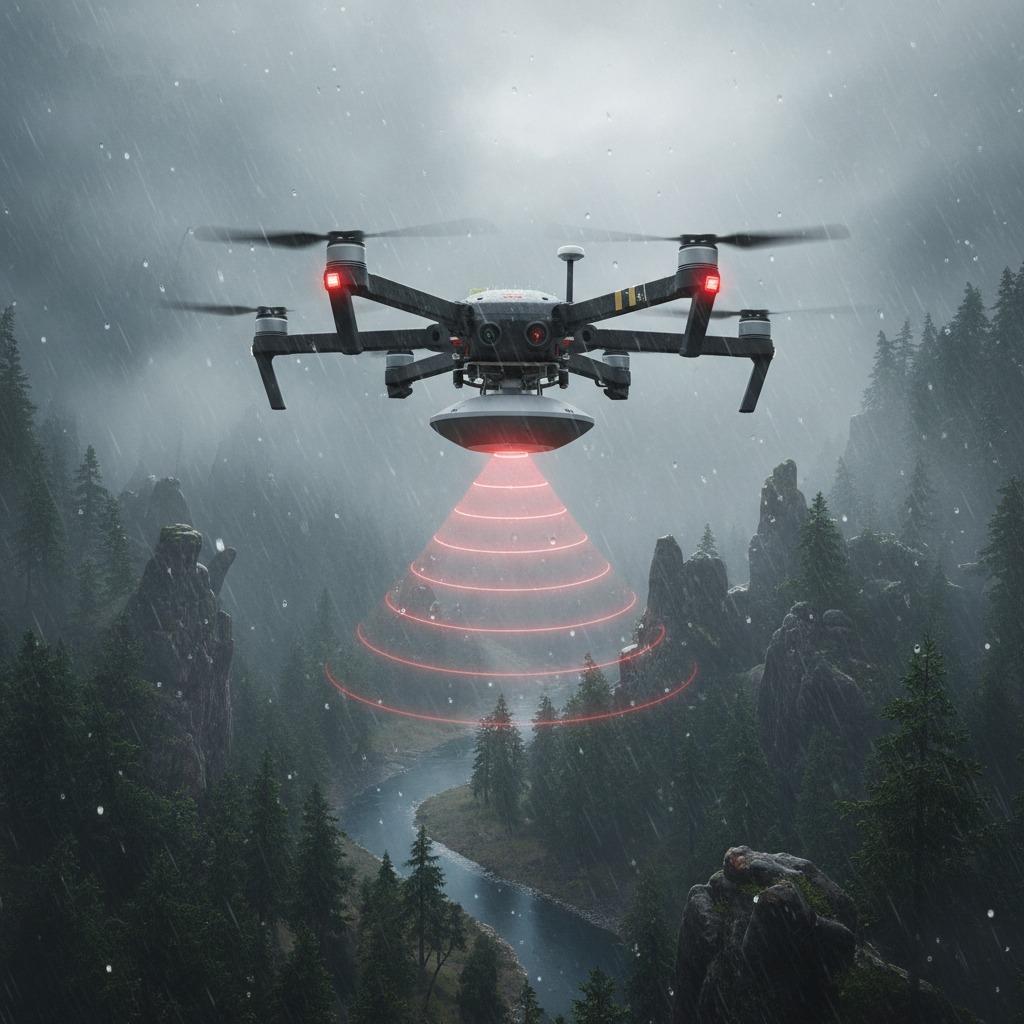
Introducing the Drone Radar Altimeter as a Reliable Solution
The drone radar altimeter addresses these issues by providing precise, real-time altitude data using advanced radar technology. Unlike optical or ultrasonic sensors, a drone radar altimeter operates effectively in diverse environments, including fog, rain, or over uneven terrain, ensuring consistent performance. This technology measures the distance to the ground by emitting radio waves and analyzing the echo, delivering accuracy up to centimeters even at high speeds. For drone pilots, integrating a drone radar altimeter means enhanced control and reduced risk, making it an essential upgrade for professionals and hobbyists alike.
Key Features of Radar Altimeter for Drones
When exploring options for radar altimeters for drones, consider systems that offer compact design and low power consumption, ideal for lightweight UAVs. Drone altitude measurement becomes seamless with these devices, supporting ranges from a few meters to over 100 meters. Aerial drone radar systems like these provide not only height data but also velocity information, aiding in autonomous navigation. Precision altimetry in drones is elevated through features such as interference rejection and multi-target detection, ensuring reliable operation in cluttered airspace.
Advanced Integration with Linpowave mmWave Radar
For cutting-edge performance, the Linpowave mmWave radar stands out in the realm of drone technology. This compact sensor utilizes millimeter-wave frequencies for superior resolution and minimal latency, making it perfect for demanding tasks like precision agriculture or infrastructure inspection. The Linpowave mmWave radar integrates easily with existing drone platforms, offering plug-and-play compatibility that simplifies setup. By solving the core problem of altitude uncertainty, it empowers users to achieve missions with confidence, highlighting the evolution of aerial drone radar systems.
Benefits and Future Applications
Adopting a drone radar altimeter transforms potential pitfalls into opportunities for innovation. In industries like filmmaking or environmental monitoring, accurate drone altitude measurement prevents costly errors and boosts productivity. Precision altimetry in drones opens doors to advanced features like automated landing and obstacle avoidance, future-proofing your fleet. As technology advances, solutions like the Linpowave mmWave radar will continue to refine aerial drone radar systems, ensuring drones operate safely and efficiently in an increasingly complex airspace.