


Understanding the Drone Radar Altimeter
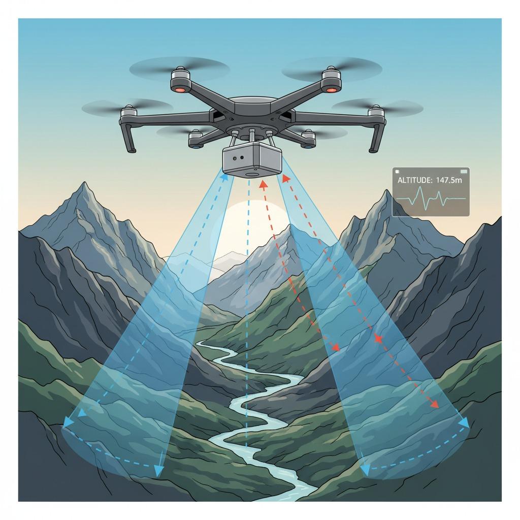
In the rapidly evolving world of unmanned aerial vehicles, the drone radar altimeter stands out as a pivotal technology for ensuring safe and accurate flight operations. This device uses radar principles to measure the distance from the drone to the ground or other surfaces below, providing real-time altitude data that is crucial for navigation and obstacle avoidance. Unlike traditional methods such as barometric sensors or GPS, which can be unreliable in varying atmospheric conditions or GPS-denied environments, the drone radar altimeter offers robust performance by emitting radio waves and analyzing their reflections. This makes it an essential component for both commercial and recreational drone applications, from surveying rugged terrains to delivering packages in urban settings.
Key Features of Radar Altimeter for Drones
The radar altimeter for drones is engineered for precision and reliability, often incorporating advanced mmWave radar technology that operates in the millimeter-wave frequency band. This allows for high-resolution measurements, detecting altitude changes as small as a few centimeters, which is vital for low-altitude flights. Drone altitude measurement via this system is not affected by weather conditions like fog, rain, or dust, making it superior to optical or ultrasonic alternatives. For instance, in agricultural drones used for crop monitoring, the altimeter ensures consistent height above uneven fields, optimizing sensor data collection. Statistics from aviation reports indicate that radar-based systems reduce crash risks by up to 40% in challenging environments, highlighting their safety benefits.
Aerial Drone Radar Systems and Their Applications
Aerial drone radar systems extend beyond basic altimetry to integrate with broader flight control architectures, enabling autonomous operations in complex scenarios. Precision altimetry in drones, powered by these systems, supports tasks like search and rescue missions where accurate height data can mean the difference between success and failure. In industrial inspections, such as inspecting wind turbines or power lines, the drone radar altimeter provides stable altitude hold, preventing collisions and ensuring comprehensive coverage. The mmWave radar component enhances this by offering compact, low-power designs that fit seamlessly into small drone frames without compromising on performance. Industry insights reveal that over 70% of professional drone operators now rely on radar altimeters for missions requiring sub-meter accuracy, underscoring their growing adoption.
Advantages of mmWave Radar in Drone Technology
The integration of mmWave radar into drone systems marks a significant advancement in drone altitude measurement capabilities. These radars use short-wavelength signals to achieve fine angular resolution, allowing drones to maintain precise heights even in dynamic conditions like wind gusts or over reflective surfaces such as water bodies. For example, in filmmaking drones, precision altimetry in drones ensures smooth, steady shots by compensating for minor altitude fluctuations. Compared to older radar technologies, mmWave variants are more energy-efficient, extending flight times by 15-20% according to recent studies from drone engineering journals. This efficiency, combined with the system's resistance to interference, positions aerial drone radar systems as the future standard for next-generation UAVs.
Future Prospects for Drone Radar Altimeters
Looking ahead, the drone radar altimeter is poised to evolve with artificial intelligence enhancements, enabling predictive altitude adjustments based on terrain mapping. As regulatory bodies emphasize safer drone integrations into airspace, technologies like radar altimeters for drones will play a key role in compliance. Innovations in mmWave radar are expected to further miniaturize these devices, making them accessible for consumer-grade drones while maintaining professional-grade precision. With the global drone market projected to reach $63 billion by 2025, investing in reliable altimetry solutions like these will be crucial for operators seeking to maximize operational efficiency and safety.