







Why fine-grained surface mapping is harder than it sounds
Fine-grained surface mapping is often treated as a data-processing step, but in practice it is a decision-making tool. Engineers, planners, and GIS teams use it when coarse terrain models are not enough: a curb line matters, a drainage break matters, a rooftop edge matters, and a shallow rut can change how water, vehicles, or structures behave. The challenge is that real surfaces are messy. Vegetation hides geometry, shadows obscure edges, radar and optical data do not behave the same way, and urban scenes are full of occlusion. If the map is only approximate, the downstream result can be expensive rework or a poor design call.
That is why the right approach is less about collecting more data and more about choosing the right combination of sensors, resolution, and processing logic for the decision you actually need to make.
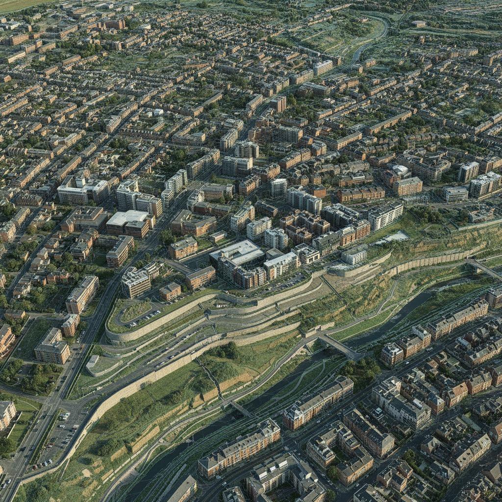
What good surface detail changes for the reader
In practical terms, high-detail mapping helps answer a few common questions. Where exactly does the ground break? Which roof plane is actually accessible? How do a road embankment and adjacent ditch connect? Where are the micro-features that influence runoff, earthwork, line-of-sight, or asset placement? When those details are captured cleanly, teams can reduce guesswork in design reviews and field verification.
This is also where the value of 3D urban modeling becomes clear. A believable model is not just visually useful. It supports planning, clash checking, route analysis, and infrastructure work that depends on knowing how surfaces meet in the real world.
Quick reference: which method fits which problem
There is no single best workflow for every site. A sensible choice depends on the surface, the scale, and how much obscuration you expect.
Optical photogrammetry
Useful when you need broad coverage and visible texture is strong. It is often effective for open terrain, construction progress, and building exteriors. The limitation is plain enough: if the surface is hidden, the model will guess where it cannot see.
LiDAR-based capture
Usually preferred when geometric precision and elevation detail matter more than appearance. LiDAR handles irregular terrain well and can sometimes better separate ground from vegetation. Still, buyers should be cautious about assuming every point cloud is automatically clean; classification and filtering quality matter.
Radar-supported analysis
Radar can be valuable when weather, lighting, or surface penetration issues complicate optical work. Orthophoto enhancement via radar is especially interesting when a team needs to improve interpretability across difficult scenes, though the fusion step needs disciplined alignment.
Where the process succeeds or fails
Fine detail comes from a chain of decisions, and weak links show up fast. Data capture must have enough spatial resolution for the smallest feature of interest. Ground control or reference geometry must be consistent. Registration between datasets needs to be tight. And the final surface model should be checked against the intended use, not just against a pretty visual render.
One practical caution: teams sometimes ask for maximum resolution everywhere, then discover they have created a large dataset that is expensive to process and still not especially useful. Better to define the critical features first. A trench wall, a drainage swale, a curb return, or a facade seam may need far more detail than the surrounding area. The job is to allocate effort where the risk sits.
Selection criteria that matter in the field
When choosing a mapping workflow or service, buyers should look beyond the brochure claims and ask how the system performs under real site conditions.
First, ask whether the workflow can preserve breaklines and small geometry. Second, check how it handles mixed surfaces such as concrete, asphalt, bare soil, glass, and vegetation. Third, review whether the output is usable for downstream engineering tools, not only for visualization. Fourth, consider whether the team can support infrastructure contour extraction in locations where slopes are subtle and edges are easy to miss.
Terrain feature matching is another quiet but important point. If the map will be compared across seasons, survey dates, or sensor types, the method must align features reliably instead of simply matching overall shapes. That is where many otherwise respectable datasets get awkward.
Common mistakes buyers make
The first mistake is treating all surface maps as interchangeable. A city model, a roadway survey, and a hillside runoff study may all use 3D data, but they do not ask the same questions. The second mistake is overfocusing on color or presentation. A crisp orthomosaic can hide elevation errors that matter more than the imagery itself. The third mistake is underestimating edge cases such as shadows, tall vegetation, reflective roofs, or steep cuttings.
Another recurring issue is timing. If a site changes quickly, a model that was adequate last month may no longer support the current design review. That sounds obvious, but it is often missed until someone on the project notices that the map and the ground have quietly drifted apart.
A practical way to decide what you need
If your team is trying to choose between mapping options, start with the feature size you must detect, then the environment, then the downstream use. If the answer involves small geometry in a built environment, lean toward higher-fidelity capture and careful fusion of sources. If the answer involves broader planning over open terrain, a lighter workflow may be enough. If you need both appearance and structure, a combined approach often makes more sense than chasing one sensor to do everything.
For infrastructure work, ask for sample outputs over a site that resembles your own. The difference between a good generic demo and a usable project file can be significant. And if the task involves repeated monitoring, make sure the process is repeatable, not just impressive once.
FAQ
Is fine-grained mapping only for large projects?
No. Small sites can benefit just as much, especially when a small geometric error can affect drainage, fit-up, or safety.
Do I need multiple sensors?
Not always, but mixed conditions often reward multisensor workflows. Optical data gives context, while elevation-focused methods help confirm geometry.
How do I know the output is good enough?
Test it against the real decision you need to make. If the model supports that decision without extra field checks, it is doing its job.
What to ask for next
If your project depends on surface detail, request a sample workflow, an explanation of how the data is aligned, and a look at how small features are preserved in the final output. Fine-grained surface mapping is most valuable when it helps people stop arguing about what the ground or structure actually looks like and start making the next move with confidence.