






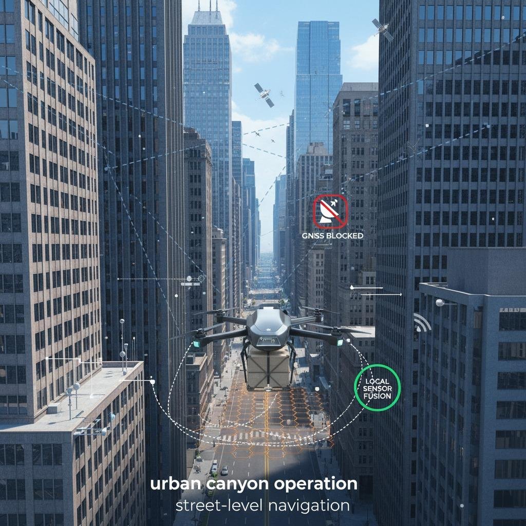
Why GPS-denied urban navigation is still a hard engineering problem
GPS-denied urban navigation is one of those topics that sounds straightforward until a vehicle, drone, or autonomous platform enters a dense downtown block and the signals start behaving badly. In open air, satellite positioning is convenient. In a city, it can turn unreliable fast. Tall buildings, glass facades, steel structures, and constant motion from traffic all distort the environment in ways that matter to engineers and sourcing teams trying to choose a dependable navigation stack.

The practical issue is not just whether a receiver gets a position fix. It is whether that fix remains stable enough for safe operation, repeatability, and downstream control logic. A platform can tolerate a small amount of drift. It cannot tolerate sudden jumps caused by reflections, signal blocking, or temporary loss of satellite visibility. That is why buyers evaluating navigation systems for delivery robots, inspection platforms, or urban mobility equipment need to think beyond a simple GPS specification.
What goes wrong in the city
The urban environment creates a cluster of failure modes that appear together. Signal blockage is the obvious one: buildings physically interrupt line of sight to satellites. But the more frustrating problem is that the receiver may still see enough satellites to report a position while the data quality quietly degrades. This is where high-rise interference management becomes a real design concern rather than a marketing phrase.
Reflections off glass and metal surfaces can produce delayed copies of the same signal. The receiver may interpret those delayed paths as valid data, which shifts the estimated position. In practice, building corner reflection can create especially messy readings near intersections, where a platform is already trying to sort out lane position, map matching, and nearby obstacles. Add turning traffic, canopy coverage, or elevated roadways, and the environment becomes difficult even for well-tuned systems.
Key decision point: what kind of urban navigation performance do you actually need?
Not every application needs the same level of autonomy. A fleet vehicle that uses GNSS as one input among several has different requirements than a drone that must hold a precise corridor between towers. Before comparing vendors, it helps to separate the use case into three practical questions: how often the system will enter urban canyon operation, how long it must perform without clean satellite input, and how much positional error the downstream system can safely absorb.
Common approaches
Most real systems use sensor fusion rather than a single sensor. That may include inertial measurement, wheel odometry, visual odometry, LiDAR-based localization, map matching, or a combination of these with GNSS when it is available. The reason is simple: GPS can be excellent outdoors, but urban navigation needs redundancy. A good platform should degrade gracefully when the sky view narrows, not fail all at once.
For many buyers, the useful comparison is not “GPS or no GPS.” It is whether the system can move from satellite-dependent positioning to local-relative positioning without a large discontinuity. That transition is where poor architectures often show themselves. Some systems recover quickly after a blockage. Others need a long reacquisition period, which can be unacceptable in a busy street-level workflow.
Selection criteria that matter on the shop floor and in procurement
Engineers tend to look first at accuracy, but procurement teams should also ask about continuity, update rate, sensor compatibility, and integration burden. Street-level navigation is rarely a one-line spec. The better question is how the platform behaves during partial degradation. Does it flag low-confidence data clearly? Can it accept external correction inputs? Does it keep time synchronization stable across sensors?
There is also a cost of complexity worth acknowledging. More sensors usually improve resilience, but they also increase wiring, calibration effort, mounting constraints, and maintenance. A compact platform may not have room for a full stack of sensors, and that physical limitation matters as much as software capability. In dense urban settings, a clean mechanical layout can be almost as important as the algorithm.
Common mistakes buyers still make
One common mistake is assuming that a GPS receiver labeled “high sensitivity” will solve city navigation by itself. Sensitivity helps, but it does not cancel reflections or restore a blocked sky view. Another is testing only in open parking lots and then discovering the system fails at the first row of towers. Real validation should include intersections, overpasses, tree-lined blocks, and at least one harsh downtown route if the application will ever see one.
A second mistake is ignoring operational fallback behavior. When satellite quality drops, what does the platform do next? Hold the last good estimate? Switch to dead reckoning? Reweight map data? These details sound minor during a demo, but they determine whether a platform stays useful in production.
Practical buyer advice for urban deployments
If your application depends on movement through dense streets, ask vendors for evidence of urban canyon operation under realistic conditions. You do not need glossy claims; you need a credible story about degradation, recovery, and sensor fusion. Ask how the system handles building corner reflection, how it detects bad GNSS data, and what happens when satellite availability drops below the expected threshold.
It is also worth asking how the navigation system supports field calibration and map updates. Urban environments change. Construction scaffolding appears, road markings fade, and reflective surfaces shift. A navigation stack that assumes the city is static will age badly.
FAQ
Is GPS-denied urban navigation completely independent of satellites?
Not always. Many systems still use GPS when available, but they rely on other sensors to maintain usable positioning when satellite data becomes unreliable.
Why is street-level navigation harder than highway navigation?
Highways usually offer a wider sky view and simpler geometry. Street-level navigation adds tall structures, tighter turns, more reflections, and frequent interruptions to line of sight.
What should I prioritize first?
Prioritize continuity and failure behavior before chasing headline accuracy. In city use, a system that degrades predictably is often more valuable than one that looks precise in ideal conditions.
What to do next
If you are sourcing a navigation solution for an urban platform, build your evaluation around real route profiles rather than lab-only results. Compare how each option performs at intersections, under bridges, alongside glass towers, and during long satellite interruptions. That will tell you much more about field reliability than a simple spec sheet ever will.