







Why urban delivery routes are harder than they look
Urban logistics drone navigation is not just a routing problem. In a dense city, the aircraft has to do more than fly from A to B. It has to recognize where it is allowed to slow down, where it is safe to descend, how to avoid temporary hazards, and how to confirm that a package is being dropped in the right place. For engineers and sourcing teams, that means the real challenge is not raw flight time. It is dependable decision-making in a space that changes by the hour.
That is why many pilot projects stall after the first demos. The drone may perform well over an empty test field, then get confused by rooftop clutter, power lines, cranes, reflective glass, parked vans, or a loading bay that is suddenly blocked. A system that works in a controlled map often needs a different sensor stack, better software logic, and a clearer operating model before it can be trusted in city traffic.
This article is meant to help you judge what matters most: whether a platform can identify a valid delivery point, sense a loading or unloading zone, adapt to urban changes, and support automated package drop-off without turning every mission into a special case.
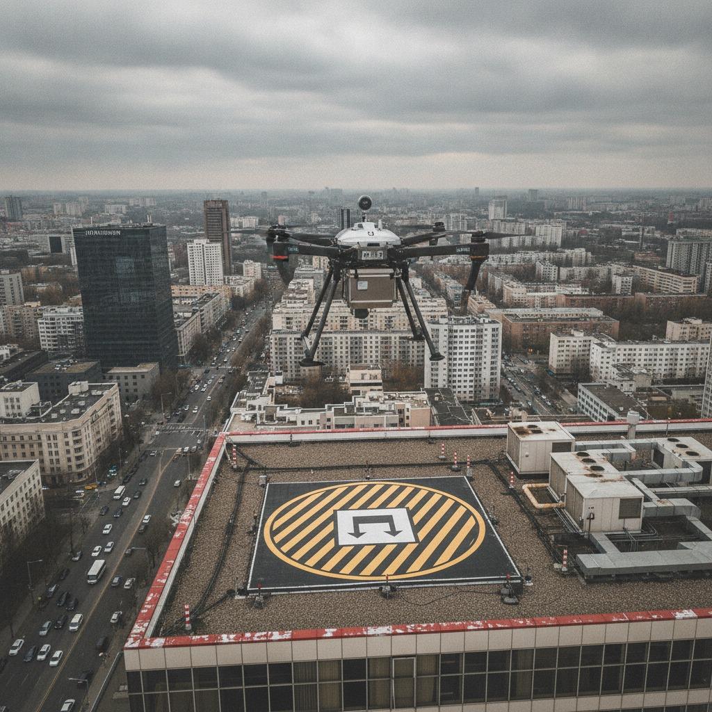
The core problem: cities do not stay still
On paper, an urban route seems straightforward. In practice, the landing area may be narrower than expected, partially shaded, or occupied by people and equipment. A courier hub on a warehouse edge today may be a construction-adjacent site next month. Even a small change, such as a new awning or a temporary scaffold, can break a preloaded route if the drone navigation system is too rigid.
That is where delivery point detection becomes more than a software feature. It becomes the gatekeeper for safety and repeatability. If the system cannot verify the correct drop zone, every other capability becomes less useful. Good navigation in urban logistics depends on how well the aircraft can interpret visual cues, map boundaries, and react to conditions that were not present in yesterday’s dataset.
What a usable urban stack usually needs
1. Reliable zone recognition
Loading/unloading zone sensing is often overlooked until the first field test. A drone needs to distinguish a designated drop zone from nearby curb space, service lanes, or public walkways. In some operations, that may require camera-based recognition, depth sensing, or a combination of sensors and site markers. The point is not to overcomplicate the hardware. The point is to reduce ambiguity when the aircraft is close to people and property.
2. A current obstacle picture
Static maps help, but city obstacles move. Vehicles stop where they should not, temporary barriers appear, and utility work can narrow a flight corridor with almost no warning. An urban obstacle database update process, whether automatic or supervised, can keep routes from becoming stale. If the database is updated too slowly, the drone will continue trusting a corridor that no longer exists. That is a small planning failure with a large operational cost.
3. Controlled drop-off logic
Automated package drop-off sounds simple until the package itself becomes the risk item. The system has to confirm altitude, position, wind conditions, and clear ground space before release. In higher-density areas, a cautious drop procedure is usually better than a fast one. Shaving a few seconds from landing time does not help if the package misses the zone or lands near pedestrians.
How to compare solution approaches
Buyers often ask whether they should prioritize onboard autonomy or cloud-connected supervision. The practical answer is that both have strengths, but the city environment tends to reward local decision-making. A drone that depends too heavily on remote communication can become vulnerable to weak signals, latency, or brief outages. On the other hand, fully onboard systems need better models, cleaner sensor inputs, and more careful validation.
For many teams, the most workable arrangement is a hybrid one. Use onboard perception for immediate navigation and safety decisions, then let a backend system handle route planning, fleet monitoring, and the periodic urban obstacle database update. That way, the aircraft is not waiting on the network to avoid a pole or confirm a zone boundary.
When evaluating suppliers or platforms, ask a simple question: can the system still make sensible choices when conditions are imperfect? If the answer depends on ideal weather, ideal lighting, and ideal map data, the deployment is not ready for city operations.
Common mistakes that slow down adoption
The first mistake is treating every rooftop, sidewalk edge, or delivery bay as if it were interchangeable. It is not. A site that looks easy on a screen can be operationally awkward because of access, visibility, or local traffic patterns. A second mistake is assuming the map will stay accurate long enough to justify a slow update cycle. In cities, maps age faster than many teams expect.
Another common issue is overfitting the system to a pilot corridor. That can create impressive demo results and weak real-world performance. Urban logistics drone navigation should be tested across multiple site types: residential rooftops, commercial loading areas, mixed-use buildings, and temporary drop points. If you only test one environment, you learn less than you think.
One more caution, and it matters: do not let the sensor stack become so complex that maintenance turns into a specialty job. A technically elegant system that needs constant tuning can be a poor choice for a fleet that must scale.
What engineers and buyers should ask before committing
Start with operational questions, not brochure claims. How does the system detect the intended delivery point? How does it confirm that the loading or unloading zone is clear? What happens when the obstacle map is outdated? Can the platform log near-misses, not just completed missions? These questions reveal whether a solution is built for an urban network or only for a controlled demonstration.
It also helps to ask how exceptions are handled. City logistics produces exceptions all the time: blocked courtyards, temporary closures, poor visibility, and unexpected human movement. A good platform does not pretend those events will disappear. It gives the operator a way to respond without restarting the entire workflow.
Practical takeaways for a pilot project
If you are planning a pilot, keep the scope narrow enough to learn something real. Choose a few representative sites, then measure how the navigation system performs when the environment changes. Pay attention to zone recognition, package placement accuracy, and how often the route logic has to be overridden by an operator. Those are the metrics that tell you whether the concept will scale.
Urban logistics drone navigation succeeds when the aircraft is treated as part of a larger delivery system, not as a novelty flying above it. The winning setup is usually the one that balances perception, routing, and update discipline with enough caution to survive a messy city block.
Next step for teams evaluating a platform
If you are comparing vendors or building an internal spec, define your target delivery environment first. Then test how well the system handles delivery point detection, loading/unloading zone sensing, automated package drop-off, and urban obstacle database update under realistic conditions. That sequence will tell you more than a polished demo ever will.